GPS was originally established to provide precise positioning for the military, and it is still controlled by the US military. Military GPS products are mainly used to determine and track the coordinates of soldiers and equipment in the field, to navigate the warships in the sea, to provide location and navigation information for military aircraft. GPS is also used in the commercial field. Consumer GPS is mainly used in surveying and mapping, aviation, navigation, vehicle tracking systems, mobile computers and cellular phone platforms.
This article refers to the address: http://
GPS is used for navigation--mainly for navigation and navigation of moving objects such as ships, cars and airplanes. E.g:
1. Marine ocean navigation and inbound water diversion
2. Airplane route guidance and approach landing
3. Car autonomous navigation
4. Ground vehicle tracking and urban intelligent traffic management
5. Emergency rescue
6. Personal travel and wild adventure
7. Personal communication terminal (integrated with mobile phone, PDA, electronic map, etc.)
GPS applied to timing calibration
1. Time synchronization of power, post and telecommunications, communication and other networks
2. Accurate time grant
3. Accurate frequency of admission
GPS for high precision measurement
1. Various levels of geodetic survey, control measurement
2. Road and various lines stakeout
3. Underwater topographic survey
4. Measurement of crustal deformation, deformation monitoring of dams and large buildings
5.GIS application
6. Construction machinery (tire crane, bulldozer, etc.) control
7. Precision Agriculture
GPS first appeared in military applications
In 1989, a group of seriously dedicated engineers and a great product concept created GARMIN, the leading brand of today's global satellite positioning navigation system, with the best sales performance and expertise. By manufacturing the first handheld GPS that was used by the coalition forces in the Persian Gulf War, and now becoming the first brand of GPS, GARMIN's products far surpass traditional GPS receivers with better functions and uses, and set up for GPS. A new milestone. In order to alleviate the shortage of military GPS receivers during the "Desert Storm" operation, the US military considered purchasing a civilian GPS receiver. The navigation function of the civilian receiving device is exactly the same as that of the military device, except that the military encrypted signal cannot be recognized. Therefore, when the "Desert Shield" military operation was reached, the US Department of Defense purchased thousands of sets of civilian GPS receivers in advance to equip the participating units, accounting for 85% of all 5,300 sets of receiving devices.
Application of GPS in road engineering
The application of GPS in road engineering is mainly used to establish various road engineering control networks and to measure the external control points of aerial surveys. With the rapid development of high-grade highways, higher requirements are put forward for surveying technology. Because the length of the line is long and there are few known points, it is difficult to meet the requirements of high precision by conventional measurement methods. At present, China has gradually adopted GPS technology to establish the first-level high-precision control network of the line, and then set up the wire encryption by conventional methods. Practice has proved that the point error within a few tens of kilometers is only about 2 cm, which is difficult to achieve with conventional methods, and also greatly advances the construction period. GPS technology is also used in the control measurement of extra large bridges. Since it does not need to be viewed, it can form a strong mesh shape, improve the accuracy of the point, and is also very effective for detecting the fulcrum of the conventional measurement. GPS technology also has broad application prospects in tunnel measurement. GPS measurement does not need to be viewed, which reduces the intermediate links of conventional methods. Therefore, it has high speed and high precision, and has obvious economic and social benefits.

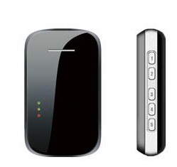
Voice MMS gps locator
Application of GPS in Car Navigation and Traffic Management
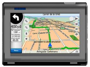
3D navigation is the primary function of GPS. Aircraft, ships, ground vehicles and pedestrians can use GPS navigators for navigation. Car navigation system is a new GPS application technology developed on the basis of global positioning system GPS. The car navigation system consists of GPS navigation, autonomous navigation, microprocessor, vehicle speed sensor, gyro sensor, CD-ROM drive, and LCD display. The combination of GPS navigation system with electronic map, radio communication network and computer vehicle management information system can realize many functions such as vehicle tracking and traffic management.
Application of GPS in long-distance passenger vehicle management
The first domestic professional GPS long-distance passenger vehicle management system - it combines satellite positioning technology, GPRS / CDMA communication services, GIS technology, image acquisition technology, computer network and database technology to establish a master control in the passenger transport company ( The C/S structure and the B/S structure are combined. The other is set as the sub-control. The public security department and the transportation management department and other departments establish a central system with special control. The system consists of the control center system and the wireless communication platform (GPRS/CDMA). Global Positioning System (GPS) and in-vehicle equipment form an integrated platform for all-weather, full-range driver management and vehicle tracking. The system can implement dynamic tracking, monitoring, photographing, driving records, management, data analysis, etc. for registered vehicles. Function, the monitoring vehicle can be displayed on the electronic map and save the vehicle running track data; the operating terminal can arbitrarily select the server internal LAN or the Internet to access the center and can provide the online integrated bus management data analysis and control system through the IE browser ( B/S structure);
Application of GPS Technology in Navigator
Product core features:
1) Map query
â—Ž You can search for the destination location you want to go to on the operator terminal.
â—Ž You can record the location information of places you often go to, and keep them, and you can share these location information with others.
â—Ž fuzzy query information such as gas stations, hotels, cash machines, etc. near your attachment or a certain location,
2) Route planning
â—Ž GPS navigation system will automatically plan a line according to the starting point and destination you set.
â—ŽThe planning route can set whether or not to go through certain ways.
â—Ž Planning the line can set whether to avoid high-speed and other functions.
3) Auto navigation
â—Ž voice navigation:
â—Ž screen navigation:
â—ŽRe-planning the line:

GPS navigation
Control relay is a classification of Signal Relay, is commonly used in automatic control system devices, generally used to connect and disconnect the circuit, is an important component of automatic control and remote control circuit.
Control Relay,Control Latching Relay,Industrial Control Relays,Control Equipment Relay
Ningbo Xingchuangzhi Electric Appliance Co.,Ltd. , https://www.xingchuangzhi.com